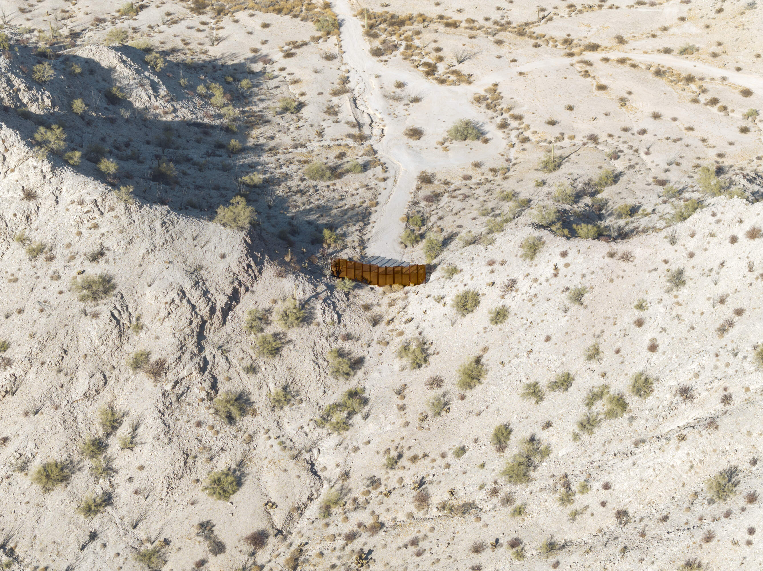
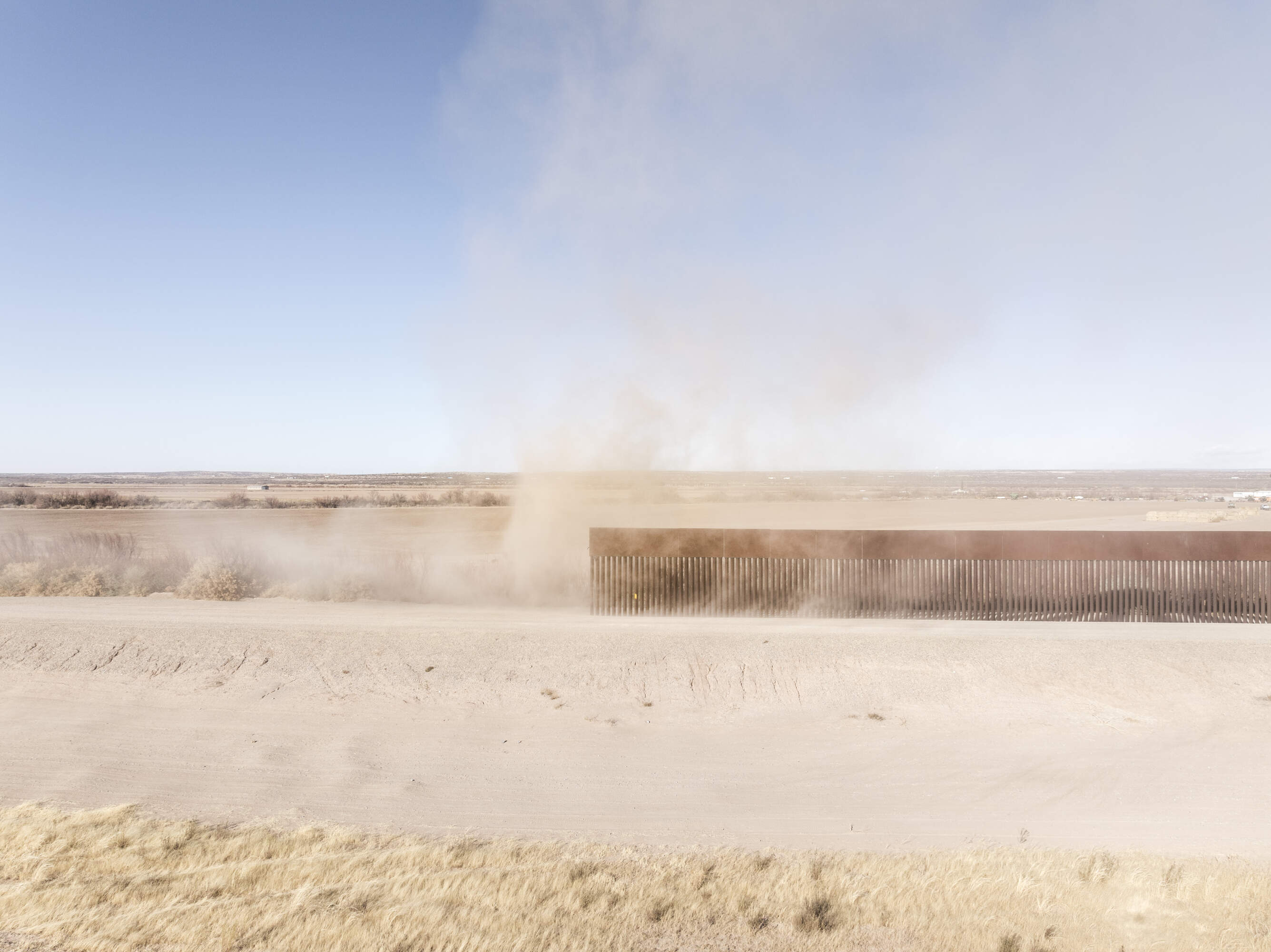
With images taken along various sections of the almost 2,000 mile long border between Mexico and the United States, Daniel Ochoa de Olza invites the viewer to question the function and material reality of this highly politicised frontier between the two countries - 'the wall' in its natural context.
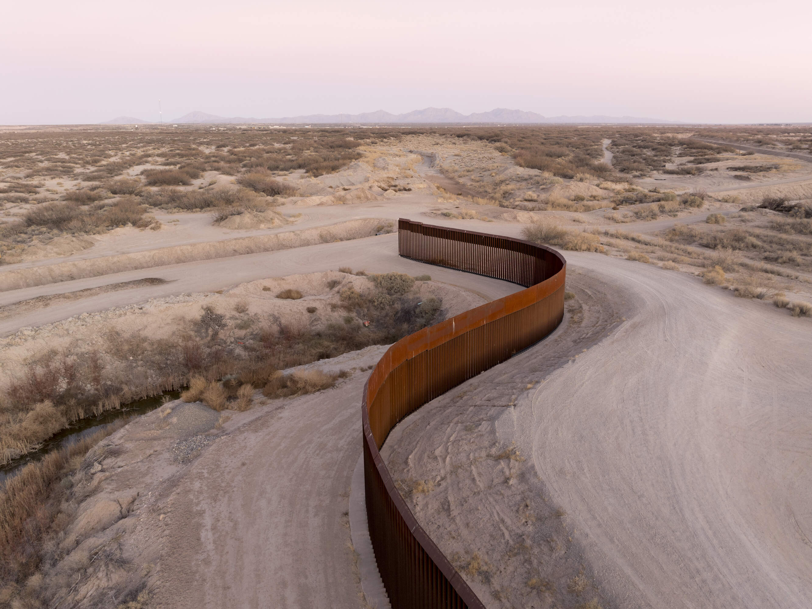
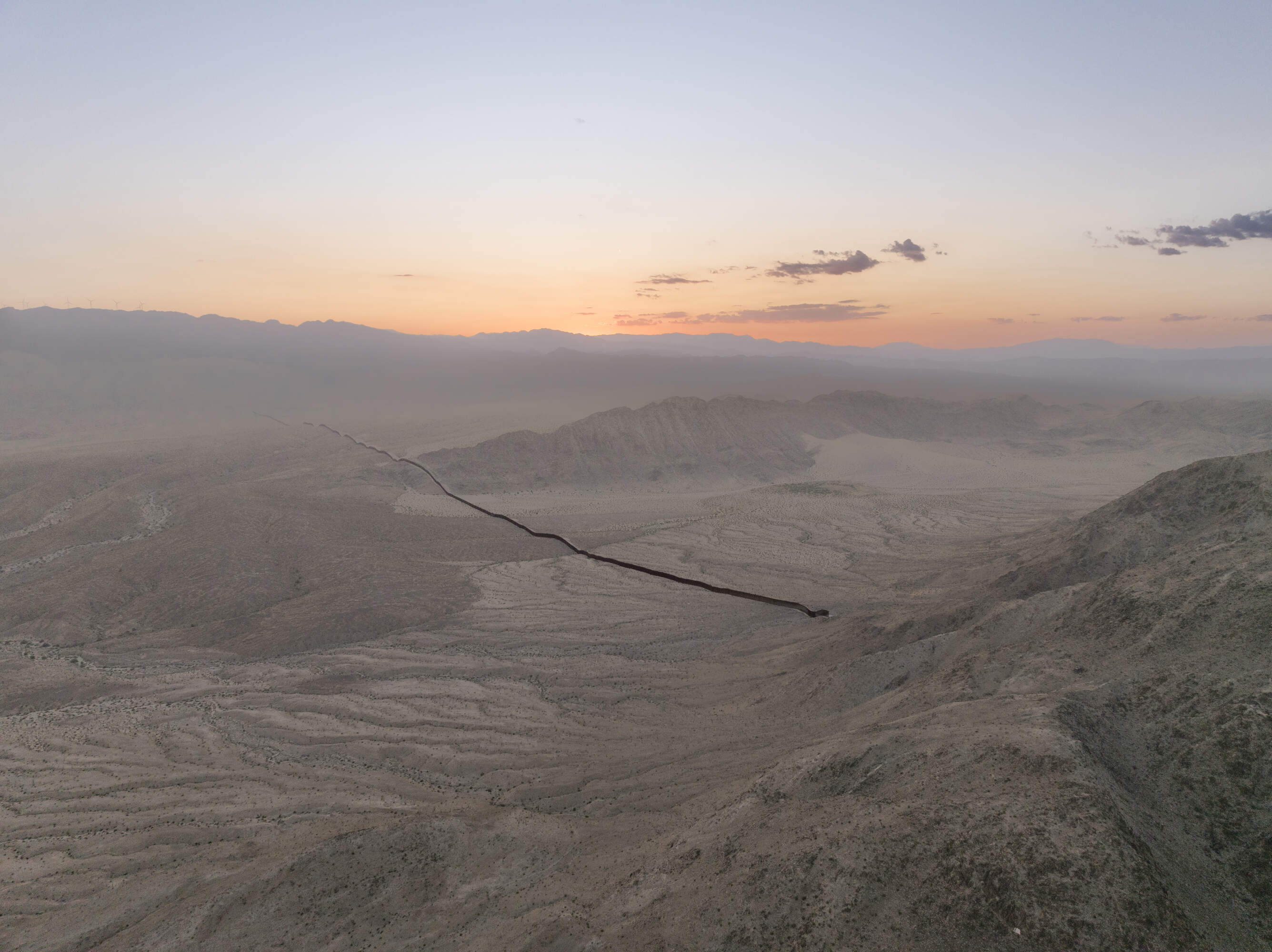
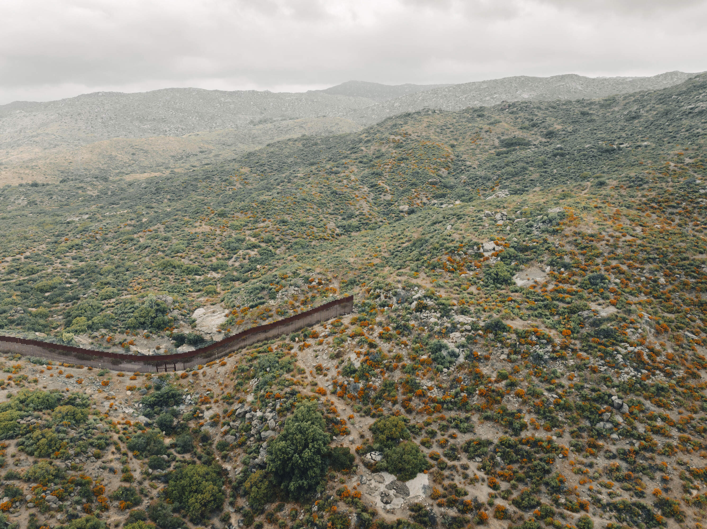
The serpentine border wall that separates Mexico from the United States ends abruptly on the outskirts of Fort Hancock Texas (23/1/25)
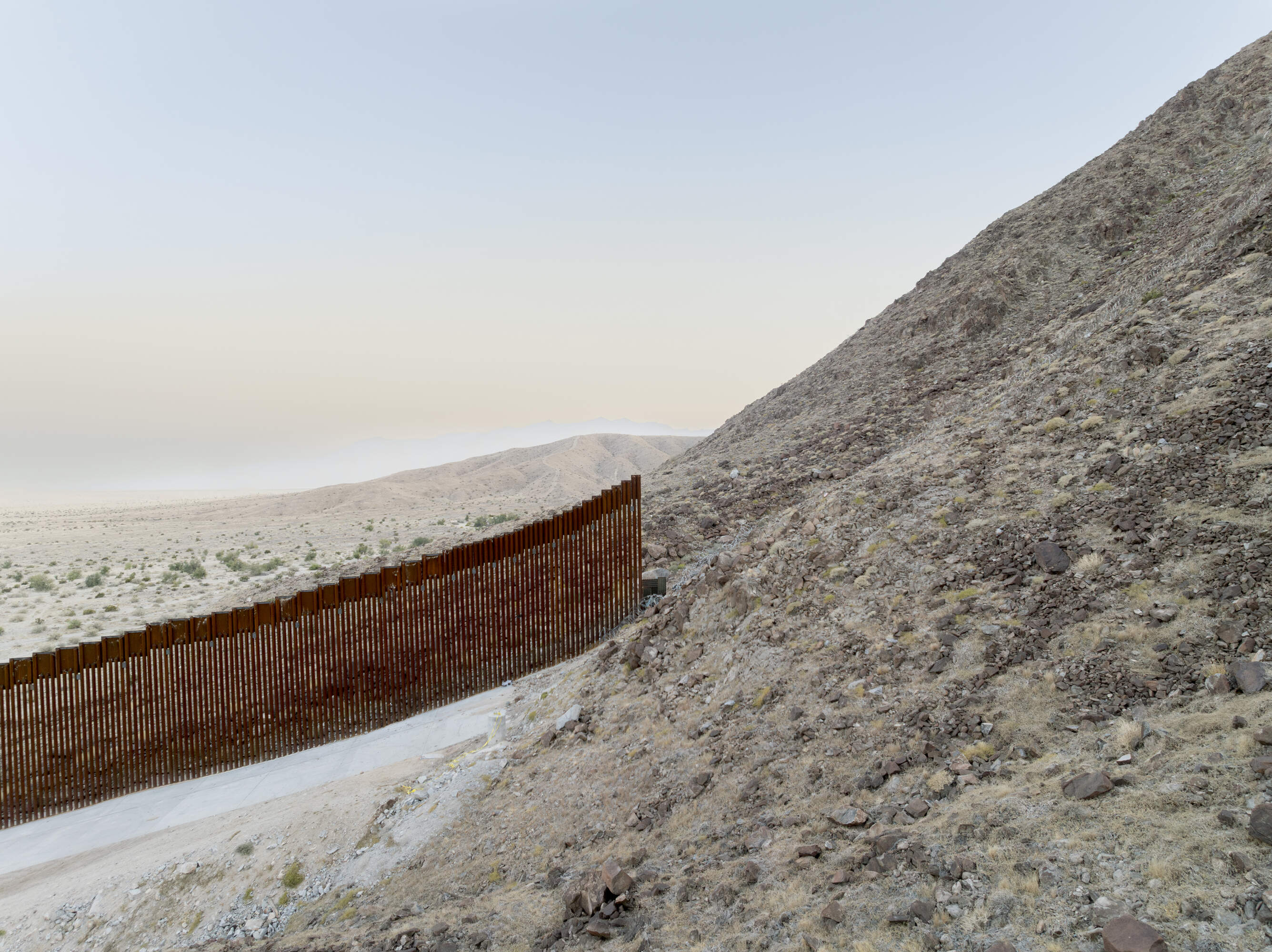
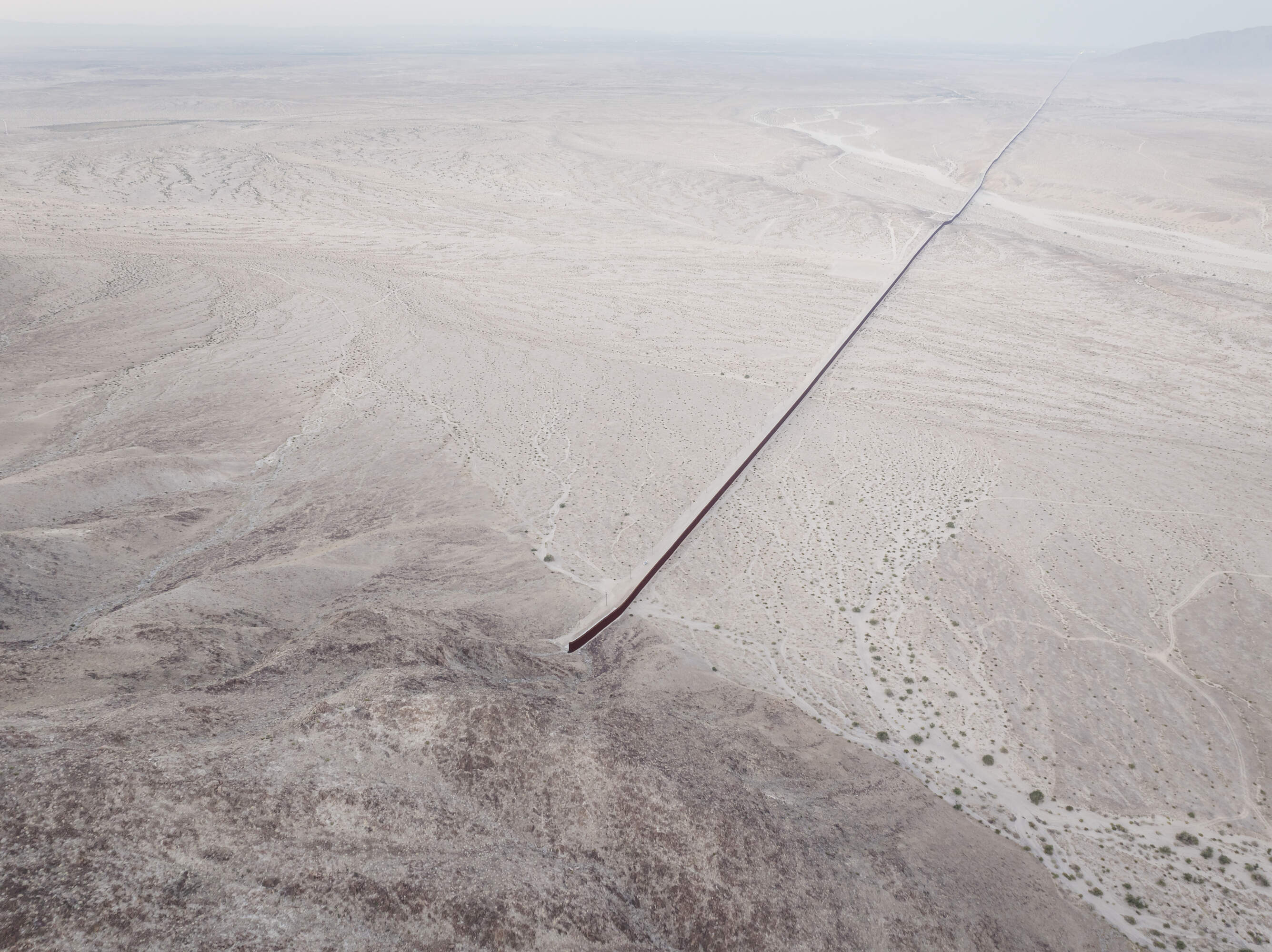
The border wall where it stops on a hillside in Imperial Valley.
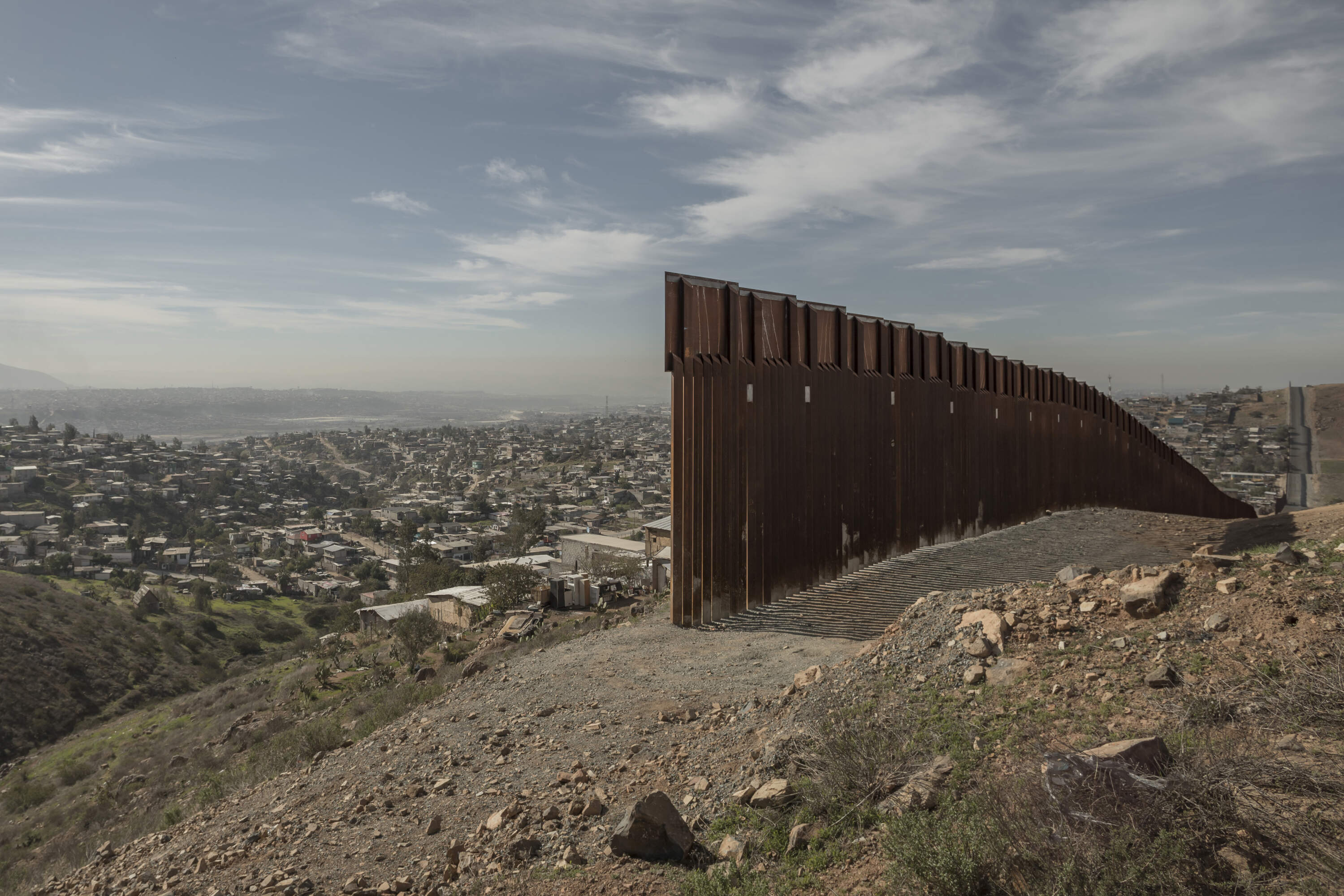
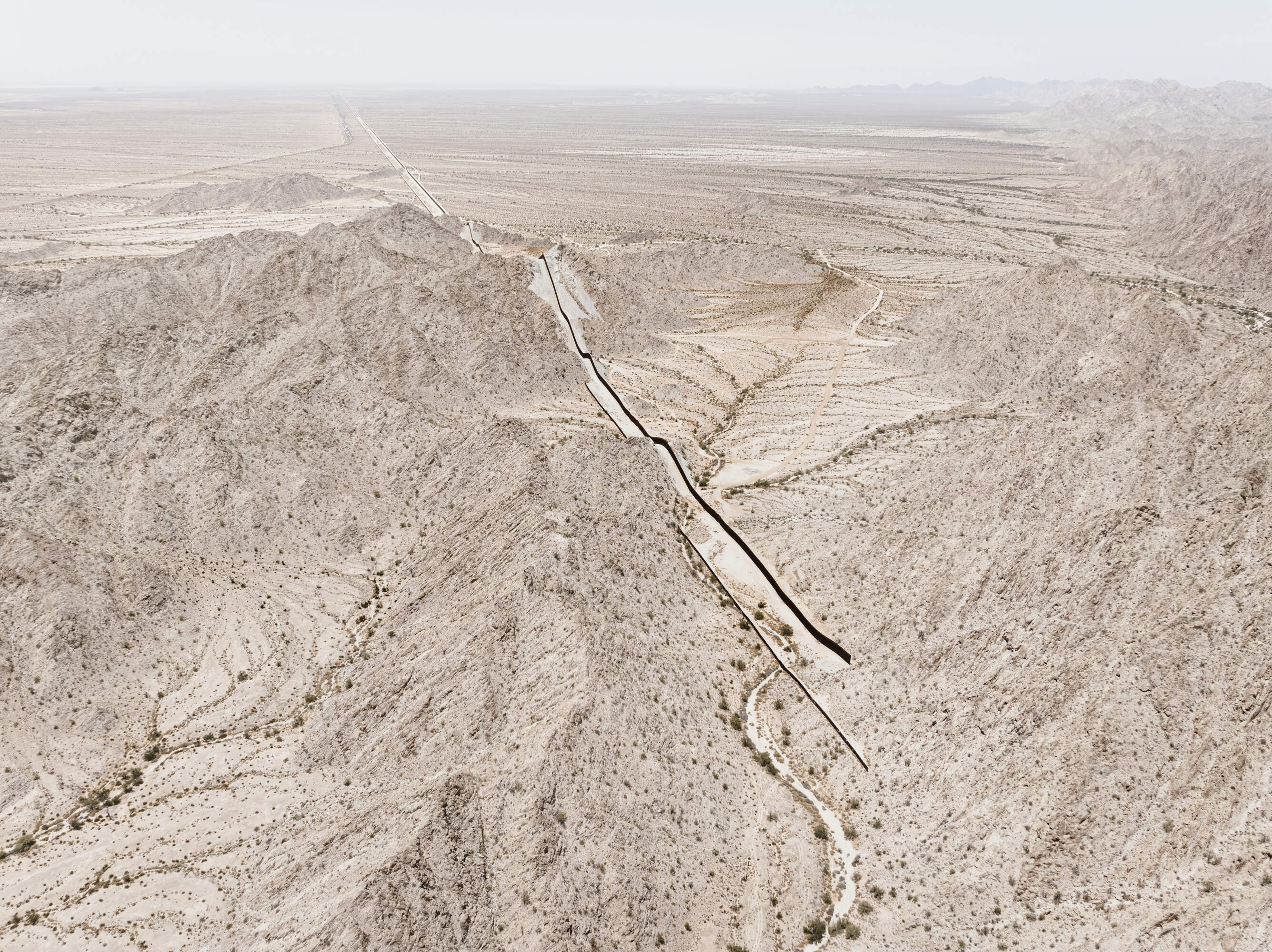
The 'Wall', much trumpeted and weaponised by US president Donald Trump , is not actually a continuous barrier between Mexico and US. Instead it consists of disparate and uneven sections of varying height and building materials with numerous gaps between them. Some sections are as short as a few metres, standing forlorn in the often inhospitable environment along the international border.
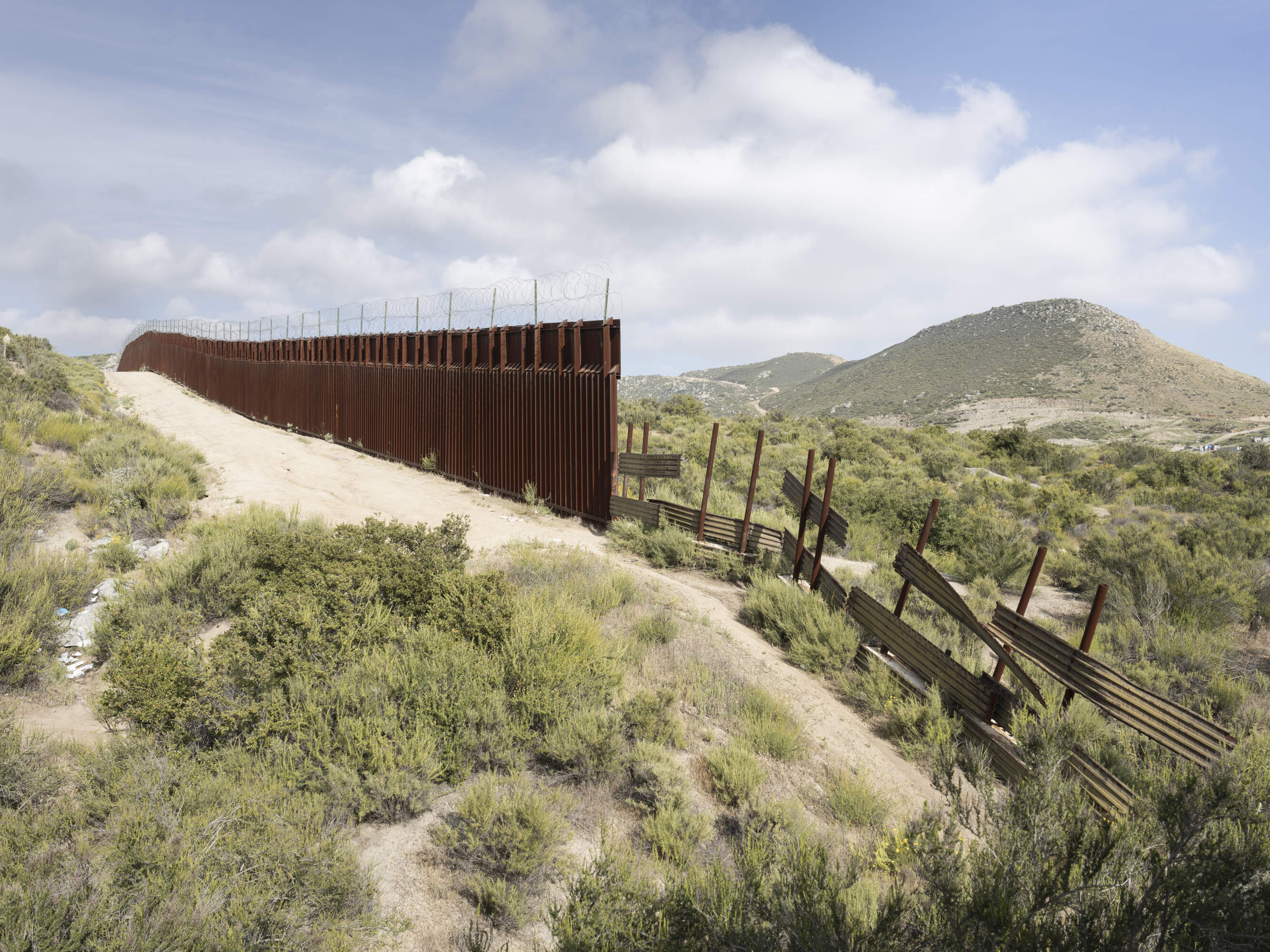
These images document this 'wall' - actually a series of fences made of steel slats varying in height between 5 and 8 metres - from up close, away from the more familiar urban settings such as Tijuana in Mexico's Baja California state, showing the arid terrain and numerous natural obstacles that have made the project so expensive and difficult to complete.
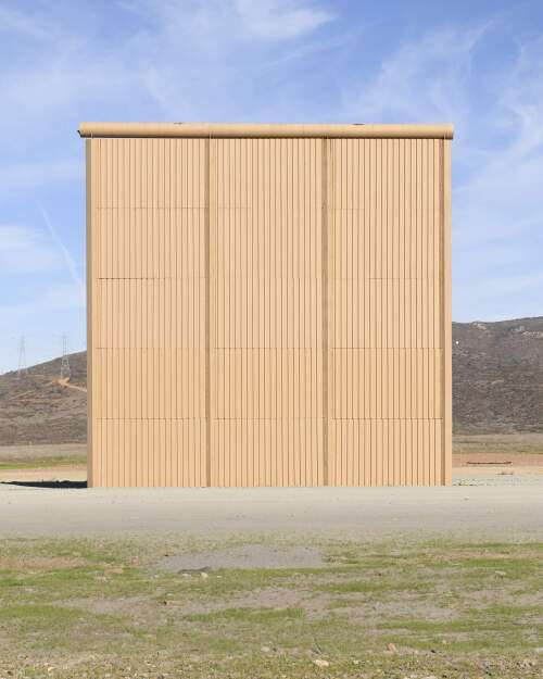
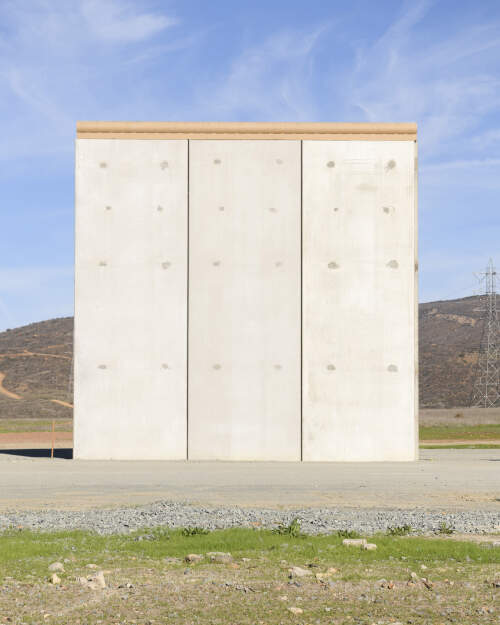
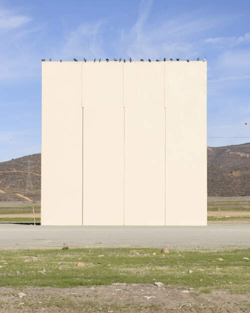
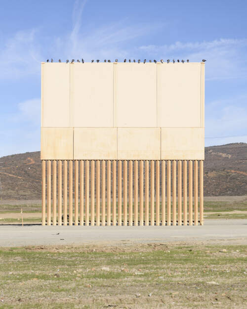
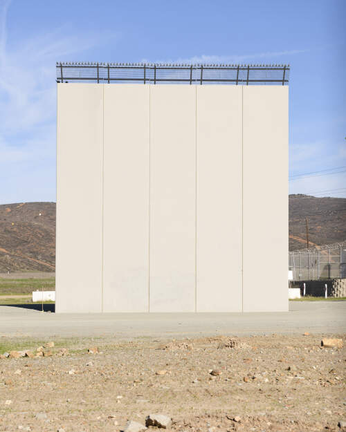
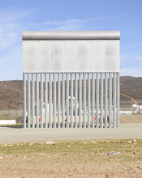
Sections of border wall fencing prototypes erected in San Diego near the Mexico/USA border, but seen from Tijuana.
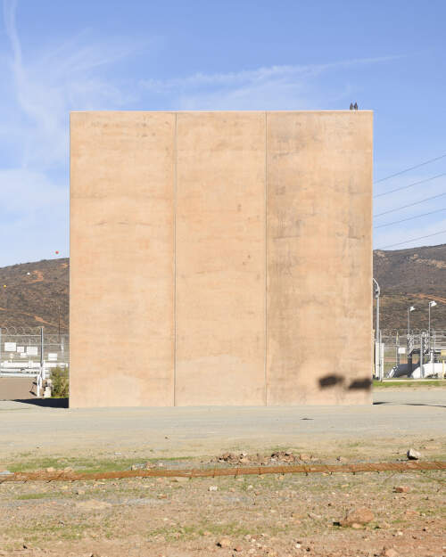
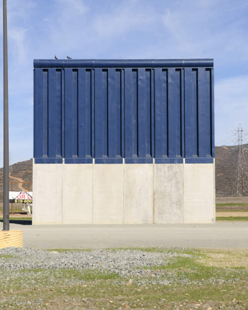
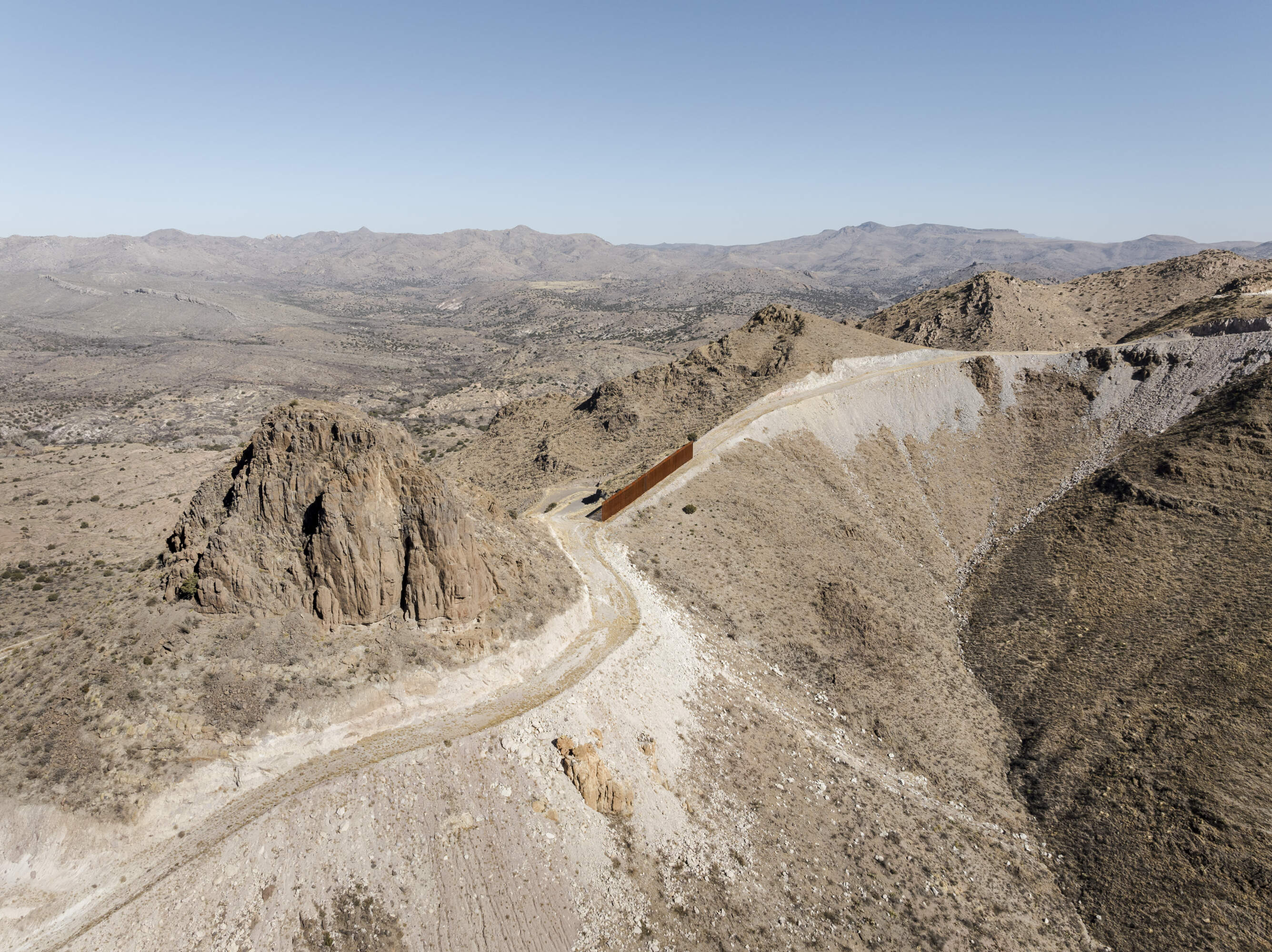
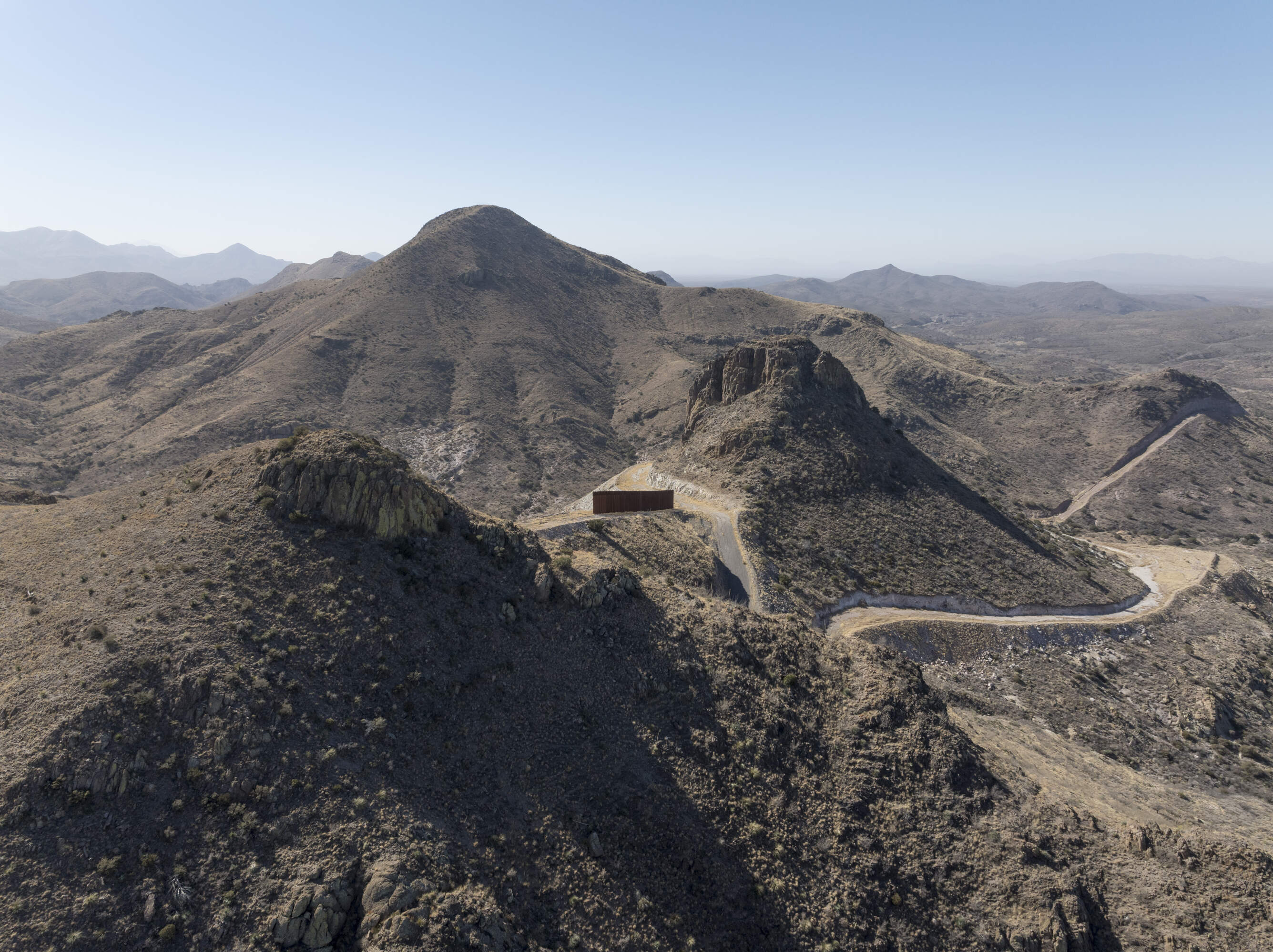
A section of the border wall separating Mexico and the United States stands atop a hill in the Guadalupe Canyon area on Jan. 21, 2025. (Photo/Daniel Ochoa de Olza)
The border, at 1,954 miles, is one of the longest in the world. The barrier is often cited as one of the most expensive engineering efforts in recent history, with some sections of the wall costing up to $46 million per mile, although the average is between $20 and $25 million, depending on the terrain and other construction challenges.
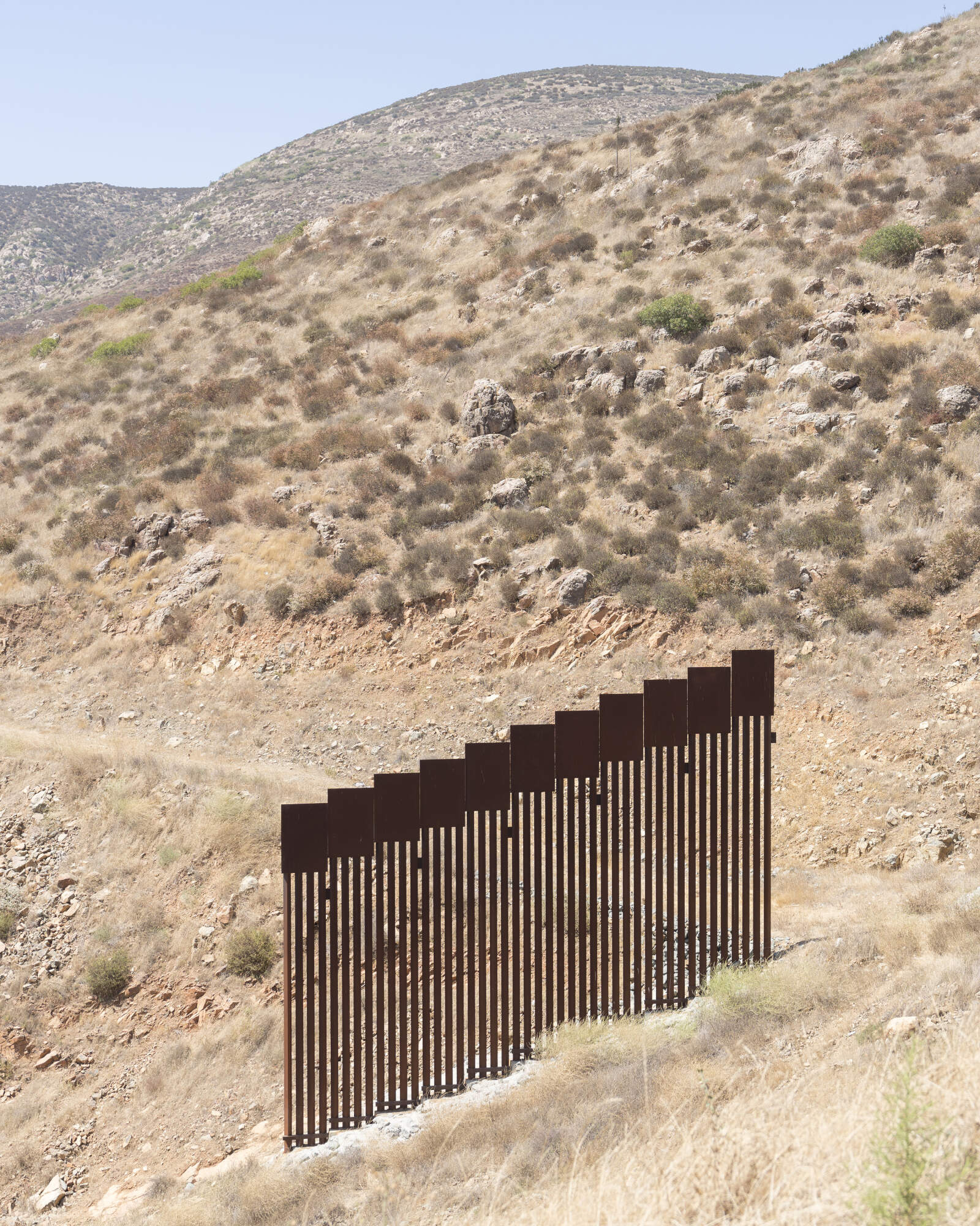
A short section of the border wall ( barrier ) in the mountains of Southern California.
So far the wall has not fulfilled its intended function. It has not stopped drug trafficking, the majority of which passes through legal entry ports. Moreover, it has singularly failed to deter migrants, both genuine asylum seekers and economic migrants. Many use a simple rope ladder to climb over the fence. The most vulnerable individuals, especially women and children, are forced to venture into extremely dangerous terrain or resort to the mafias that control sections of the wall and promise to help people across - for a price.
The fact that much of the illegal traffic across the border is now concentrated in hostile environments is the result of the so-called 'Prevention Through Deterrence' policy, introduced in the 1990s as part of U.S. immigration policy. The objective of this strategy is to tighten control in more accessible urban areas along the border, such as El Paso or San Diego, thus shifting the flow of migrants to more dangerous desert and mountain regions where extreme conditions act as a natural barrier.
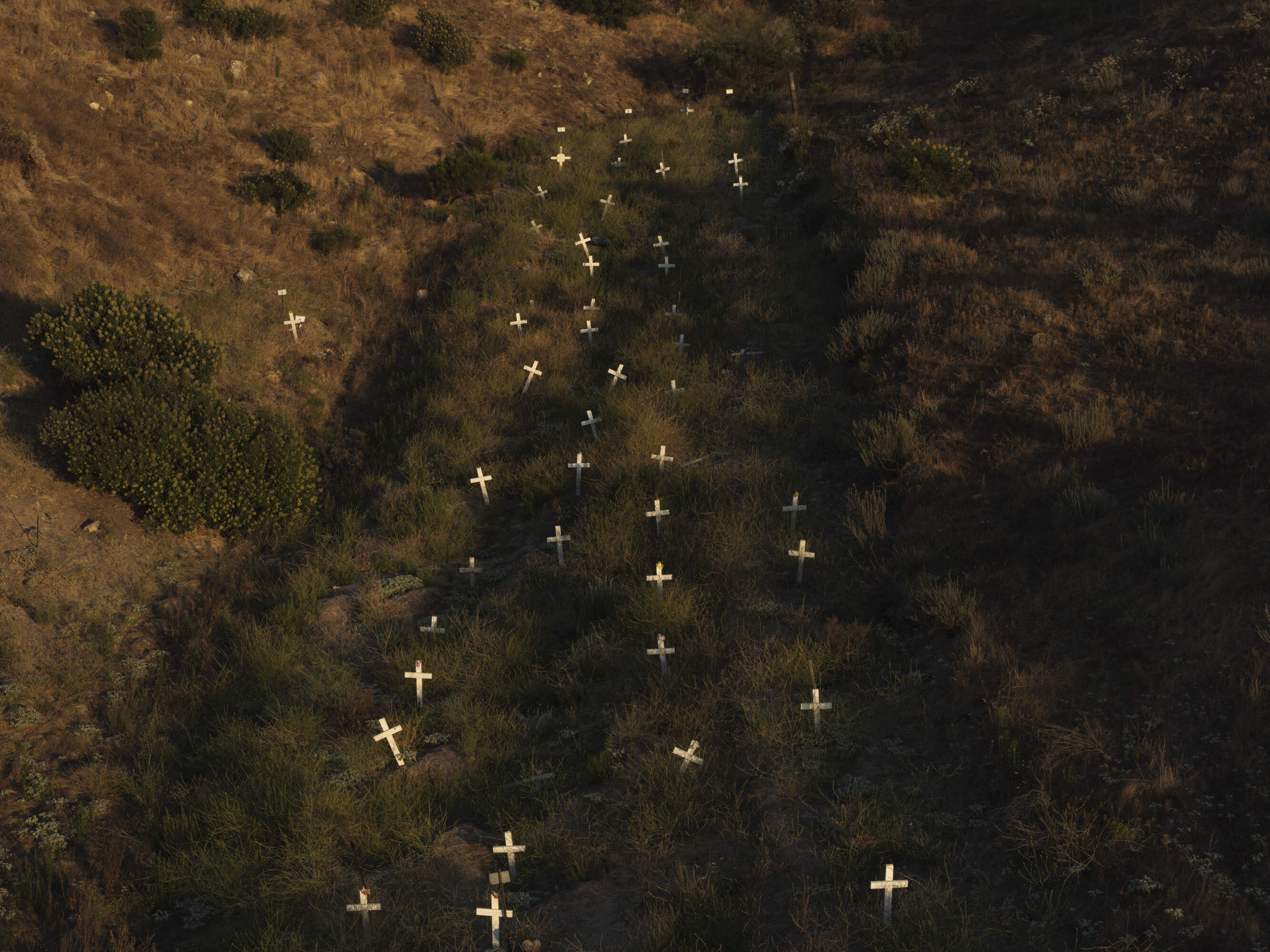
This policy has been heavily criticised for causing a huge increase in the number of deaths among migrants. Since the implementation of 'Prevention through Deterrence' more than 7,800 migrants have lost their lives at the border according to the US Customs and Border Protection Office (CBP). The number of disappearances have also risen sharply, though exact figures are hard to come by. Organisations like the Missing Migrant Project and Human Rights Watch have documented hundreds of people disappearing each year while attempting to cross the border. In 2021, it estimated that at least 1,600 disappeared while trying to reach the U.S.
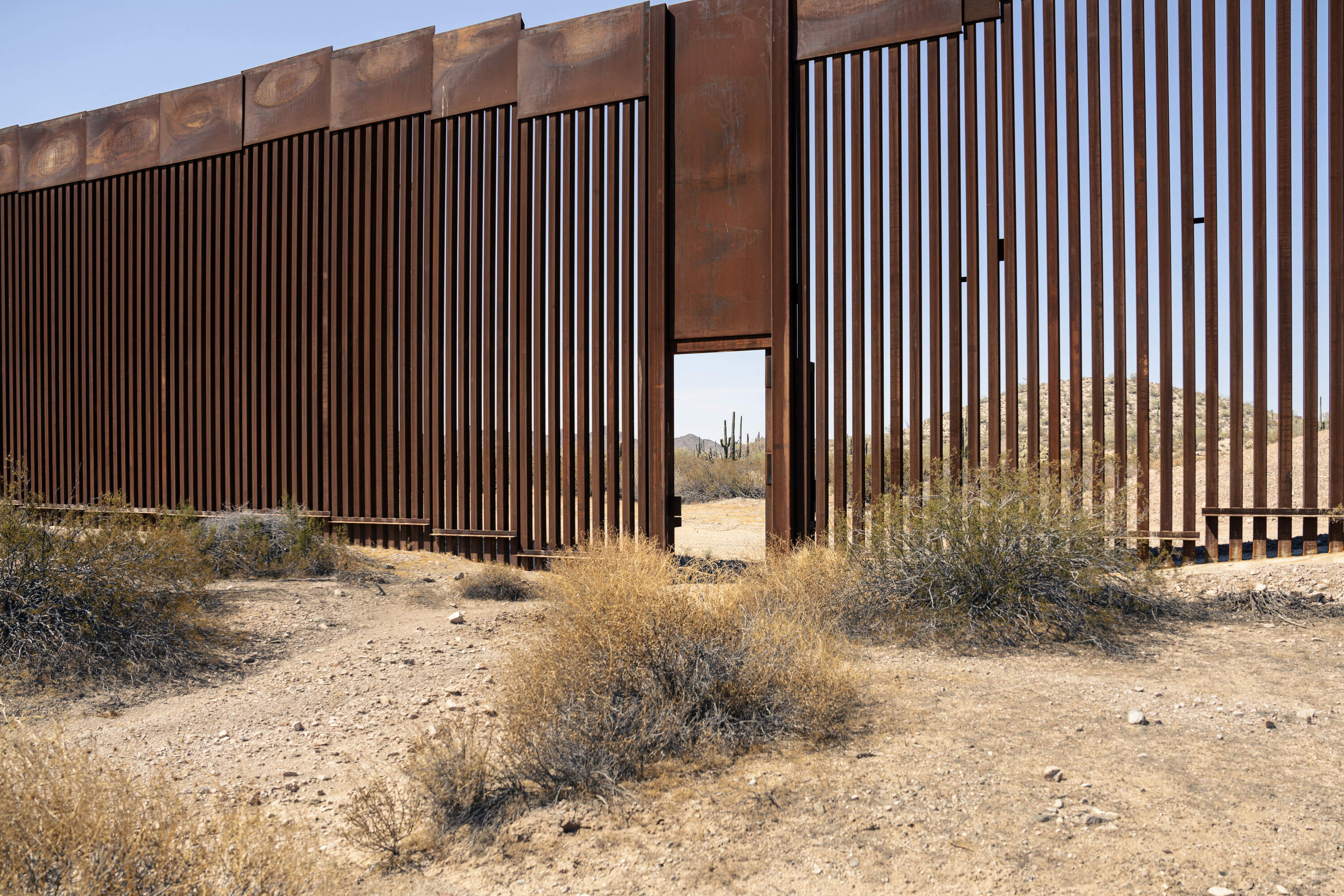
An open and uattended 'door' in the USA - Mexico border fence along the border between Sonora state in Mexico and Arizona in the US. The fence is made of interonnected steel slats.
With Donald Trump making the anti-immigration ticket and his forced relocation policy one of the central planks of his re-election manifesto 'the Wall' is once again in the spotlight.
The border wall ends in the desert near Jacumba, as seen from La Rumorosa, Baja California, Mexico
The border wall comes to a sudden stop in a desert landscape near the town of Mexicali in Baja California, Mexico
The border wall, made of tall metal slats, stops near Campo, California.
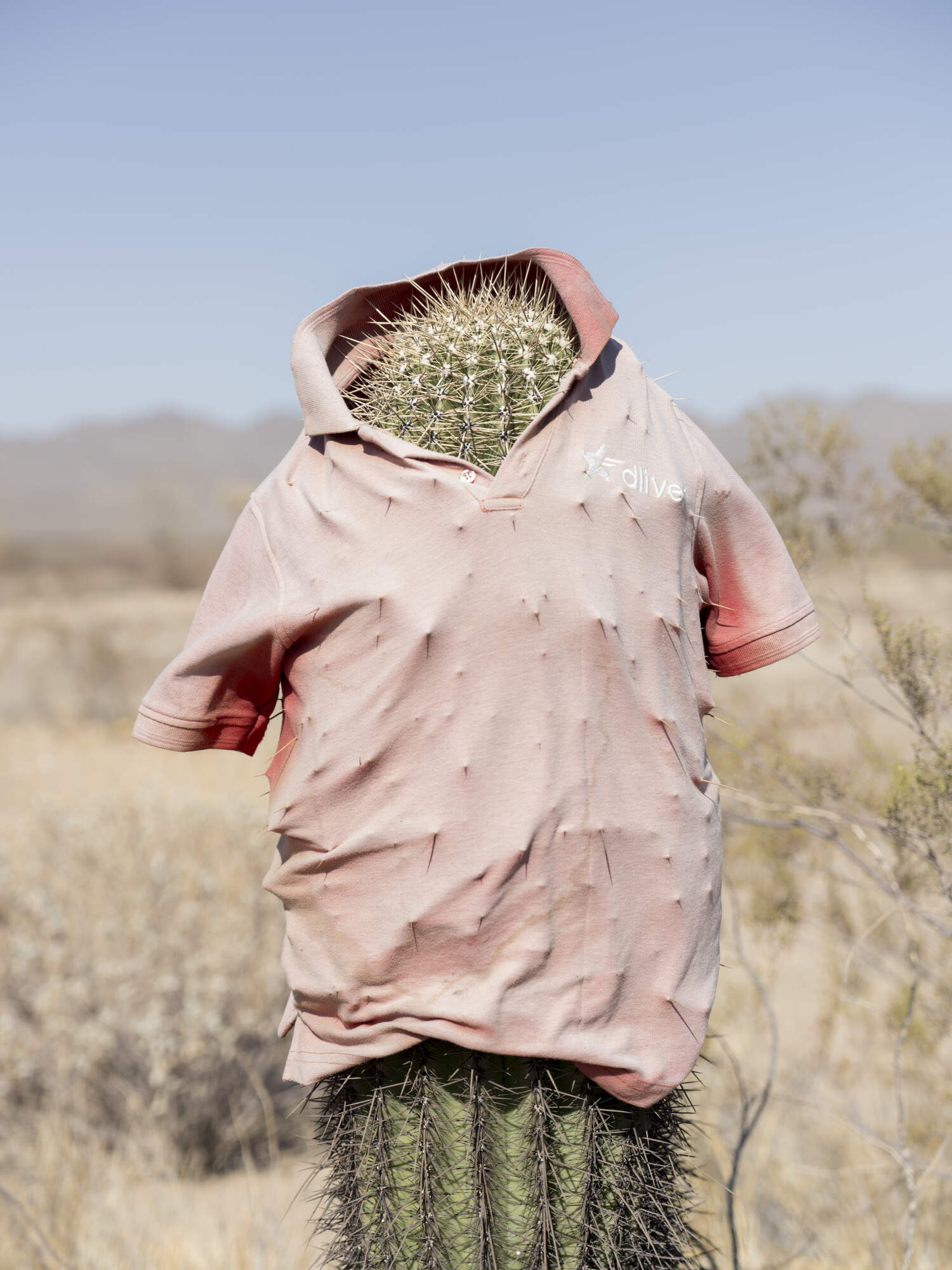
A cactus strangely dressed in a pink polo shirt marks a spot on the road that runs parallel to the border wall, between Sonoyta, and San Luis Río Colorado, in the Altar Desert, Sonora, Mexico (26/1/25)
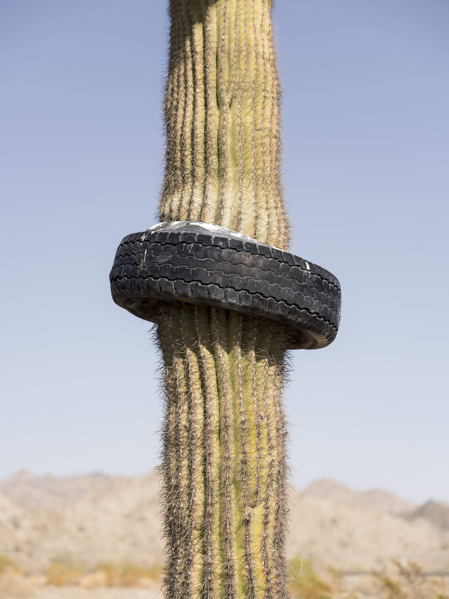
A cactus grows inside a car tyre on the road that runs parallel to the border wall, between Sonoyta, and San Luis Río Colorado, in the Altar Desert, Sonora, Mexico (26/1/25)
The border wall stops suddently in the mountains outside of Tecate, Baja California.
The border fence between Mexico and USA ending abruptly on a hill above Tijuana.
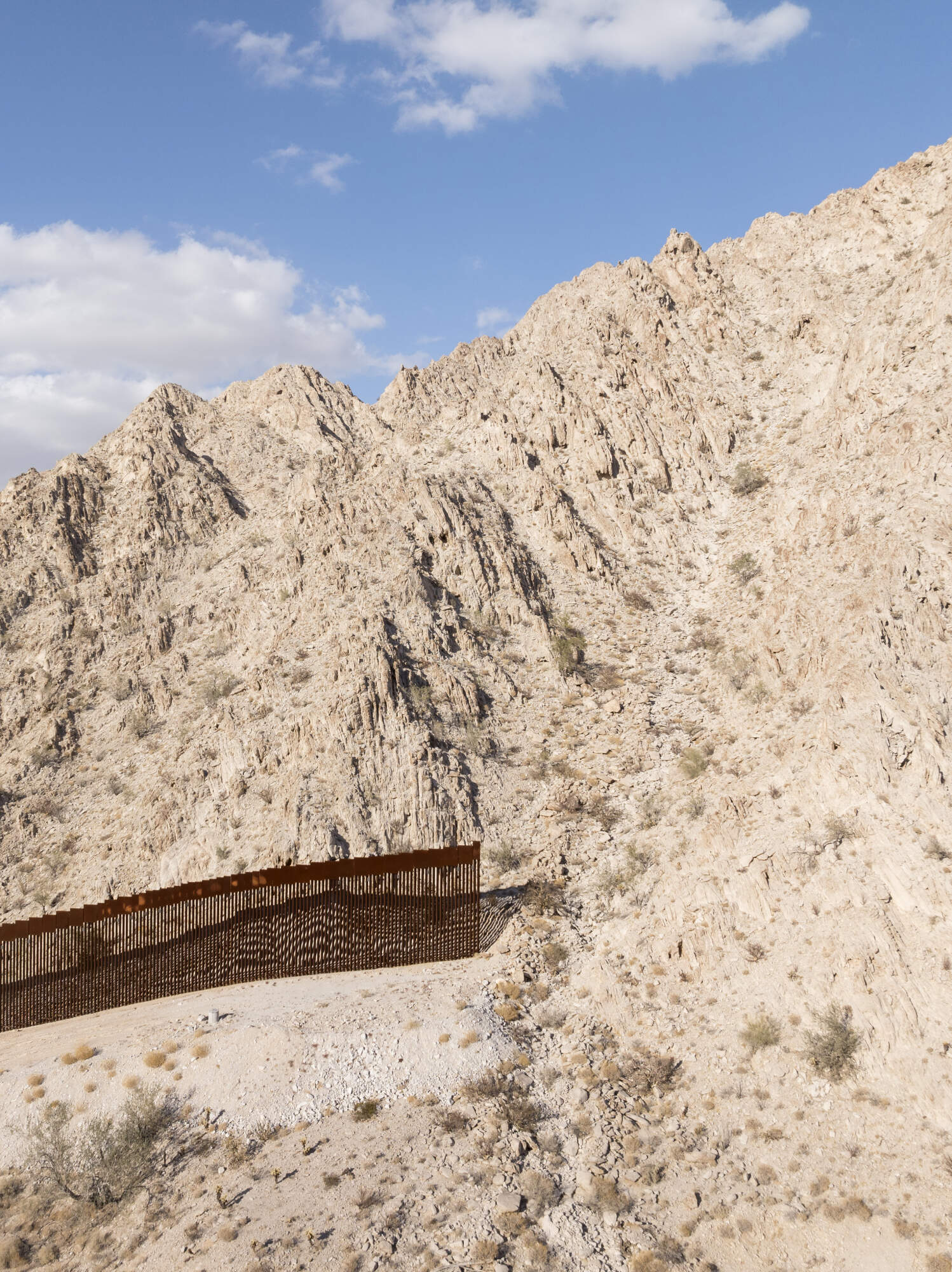
El muro termina abruptamente al llegar a las montañas de Tinajas Altas, Camino del diablo, Desierto de Altar, Sonora, Mexico. (26/1/25)
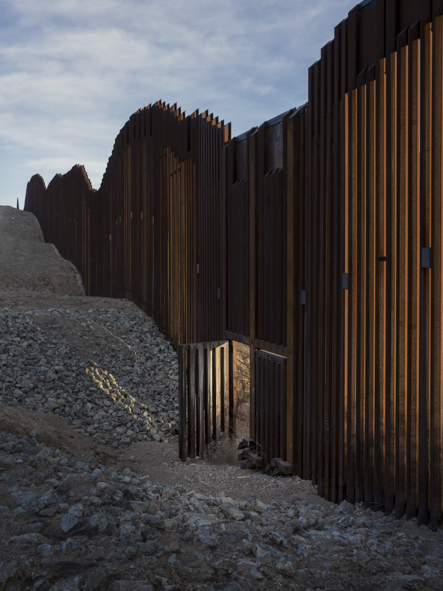
A striking open gate in the border wall separating Mexico and the United States near Douglas, Arizona, on Jan. 20, 2025. (Photo/Daniel Ochoa de Olza)
The border wall stops its run near Campo, California.
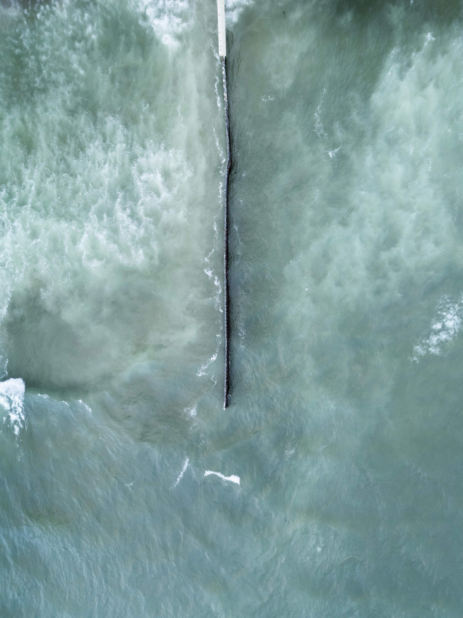
The U.S.-Mexico border fence at the point where it enters the Pacific Ocean at high tide
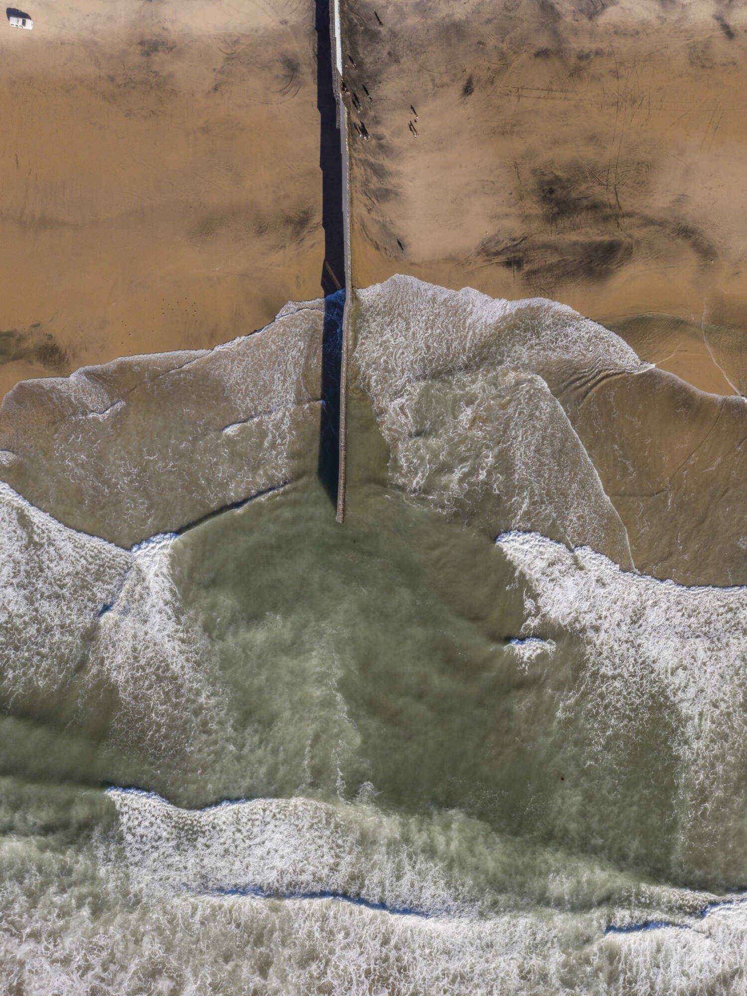
The U.S.-Mexico border fence at the point where it enters the Pacific Ocean at low tide
A very short segment of the border wall that separates Mexico from the United States appears to serve no clear purpose in the Altar Desert, Sonora (26/1/25)

